Lost on Purpose: How Hand-Drawn Maps Are Changing the Way Americans Experience Shimabara

Kayla Merritt hadn't drawn a map since the fourth grade. Then she came to Shimabara.
"My guide handed me this folded piece of paper — hand-drawn, slightly smudged — and pointed at a dot that was supposed to be the old samurai district," she said. "I laughed. Then I actually used it. And I didn't look at my phone for three hours."
That's not an accident. It's increasingly by design.
Across Shimabara's narrow lanes and spring-fed alleyways, a quiet counter-movement is taking hold. Local guides, guesthouse owners, and even the city's tourism volunteers are pressing paper maps into the hands of arriving visitors — not out of nostalgia, but out of conviction. The argument they're making, and the one travelers keep validating, is simple: the way you navigate a place fundamentally shapes how you remember it.
What GPS Actually Does to Your Brain
This isn't just vibes. Cognitive scientists have been sounding this alarm for years. When you outsource navigation to a device, your hippocampus — the part of your brain responsible for spatial memory and place-based learning — largely checks out. You arrive at your destination, but you don't really know where you are. You can't retrace the route. You can't describe what you passed. The journey becomes a loading screen.
Hand-drawn maps force a different kind of engagement. You have to read the terrain. You have to estimate distance. You make wrong turns, backtrack, and in doing so, you actually see things — the stone wall with the moss growing through the cracks, the old woman sweeping her step, the shrine gate you would have scrolled past.
In Shimabara, where so much of the character lives in the margins, this matters enormously.
The Guides Who Are Bringing It Back
Takeshi Yamamoto has been leading walking tours through Shimabara for over a decade. For the first several years, he watched visitors half-listen while staring at their phones, cross-referencing Google Maps against his every word. About four years ago, he started asking people to put the devices away at the trailhead. Some resisted. Most, eventually, complied.
"The change in people's faces — it happens fast," he said through an interpreter. "Within twenty minutes, they start asking questions. Real questions. Not 'how far is it' but 'what is that building' or 'why does this street smell like that.'"
Yamamoto now produces his own hand-drawn route cards — loose, impressionistic sketches that mark landmarks by feel rather than coordinate. The old town well. The bend where the creek sounds loudest. The spot where, on a clear morning, you can see the volcano reflected in the water.
"These are not GPS points," he said. "These are invitations."
Shimabara Is Designed for Getting Slightly Lost
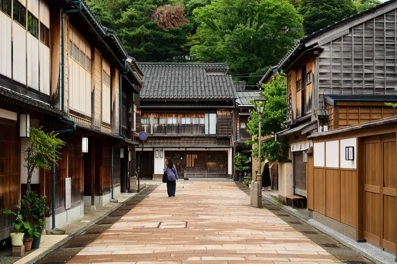
Part of what makes this work here, specifically, is the geography. Shimabara isn't a grid city. It's a peninsula with a castle at its heart, volcanic mountains pressing in from the west, and a coastline that curves and surprises. The neighborhoods built around the samurai quarters are deliberately winding — a defensive measure centuries ago, and an accidental gift to wanderers today.
When you follow a hand-drawn map through this kind of space, you're essentially doing what travelers did for hundreds of years: reading the landscape for clues, trusting your instincts at unmarked intersections, and accepting that a detour might be the point.
Jessica Tran, a landscape architect from Portland who visited last spring, described it this way: "In any other city, getting turned around feels like failure. In Shimabara, it feels like the city is offering you something extra. I found a little onsen tucked behind a restaurant because I missed a turn. It wasn't on any map — hand-drawn or digital."
What You Carry Home Is Different
The travelers who've gone analog in Shimabara tend to talk about their trips differently. Not in terms of sites checked off, but in terms of encounters accumulated. The detour. The conversation that started because they stopped to ask for directions. The thirty minutes spent sitting on a low wall, actually looking at a view instead of photographing it.
Some of them keep the maps. Kayla Merritt has hers pinned above her desk back in Nashville. It's wrinkled and has a coffee stain on one corner from a café she found by wandering off-route.
"I could never explain to someone exactly where that café was," she said. "But I could draw you a map to get there."
That's the thing about analog navigation in a place like Shimabara. You don't just find your way around. You find your way in. And that's a version of travel that no app update is ever going to replicate.